
The view from the Hastings Country Park
For this walk I used the Time Out Country Walks Near London Vol. 2 , inspired by the work of the late Nicholas Albery and written by members of the Saturday Walkers Club that he founded. I have to say the directions were excellent and very detailed but I am glad I took along Explorer Maps (Ordnance Survey) nos 124 and 125 especially for the last part. Of course, since the book was published some details change and one doesn’t need to follow the recommendations for places to eat.

High Street, Hastings Old Town

Looking back at Hastings
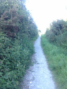
The directions were especially useful in guiding me through Hastings to the Hastings Country Park. A very undulating coastal path goes on for three and a half miles to Fire Hills.  My heart sank every time I had to go down hill, knowing this meant I had to go up again. It was obvious to me that the pharmacist, who recently checked my health, was right to classify me as ‘inactive’.
 However, of course, there were cliff views and there is nothing so pleasant as walking along a cliff top overlooking the Channel on a day, which though occasionally cloudy was warm but not too warm.

Blueberries ?


That was only the first third of the walk.I had met many walkers in the park but thereafter there were scarcely any and I had the footpaths almost to myself. Pretty remarkable for a late summer Saturday afternoon. The next section, following complicated directions by way of lanes and footpaths through, what the map tells me is Fairlight, goes along by the seaside promenade for a short while:
The route then follows the Royal Military Canal.

The path by the Royal Military Canal
This was originally planned as part of the defence of Romney Marsh against Napoleon. Construction, begun in the first years of the nineteenth century stalled and it was not as wide as originally intended. By the time it was finished, Napoleon had been defeated at Waterloo and the threat of imminent invasion was over for over a hundred years. It served and serves for flood relief in winter and irrigation in summer. Nowadays there is an excellent path, with herds of cows safely at a distance behind the rampart.
I would have happily followed the canal to Winchelsea but the guide book led me to join the 1066 Country Walk and walk under the line of what had once been cliffs by the sea.

Mushrooms or toadstools? Signs that autumn is not far away.
Thus I came to pass under the New Gate of Winchelsea.

The New Gate of Winchelsea
I was led to walk by a wall, all that remains of St John’s Hospital, a medieval shelter for the poor.

The former St John's hospital
St Thomas’s church is indeed very beautiful. 


This is new Winchelsea. The original Winchelsea having disappeared beneath the waves in the thirteenth century. The new one became wealthy through trade but the shingle drifted and ships were no longer able to reach the town. The sea is now two kilometres away.

Another gate in Winchelsea

View over Romney Marsh. I imagine this is where the sea used to be.
I didn’t find a tea shop in Winchelsea and took no refreshment but went on to Rye.
Having followed directions to the fire beacon, I had stupendous views of the marshy land spreading out to the sea. 
I then found the way through fields a little confusing

Actually not that way, keep going straight on.
but successfully arrived at a quiet lane leading to Winchelsea station . At this point I noticed that there were clearly marked sections of the 1066 Country Walk and, rather than take a less distinct path through fields, I opted to follow that. By now there were no clouds and it was a golden summer evening. Shortly after the end of the lane, the 1066 Country Walk is a concreted path with blackberry bushes either side.
The 1066 Country Walk approaching Rye
I had waited until now to fill my little box. I noticed that the bushes had only some which were ripe, unlike the bushes in South Norwood Country Park, where all the blackberries had been ripe when we had picked some the previous day.
So, after 11.8 miles my walk finished in Rye, where I took the train home.

A view of Rye Windmill


 Then, picking up the Saxon Shore Way, walked alongside Oare Creek.
  The path goes along the sea wall with the creek on one side and marsh grazing land on the other. Faversham Creek joins it and the land widens into what seems to be the estuary of the Swale leading eventually to Whitstable Bay.
  Normally it would be extremely pleasant to walk along slightly higher than the land and the water on either side, with open vistas- a remote and wild place- leading to a bird reserve. However the forecast rain made its appearance earlier than expected. In fact, as I beheld a very large, very dark cloud advancing upon me, I was horrified to observe the one kind of weather I really really wish to avoid walking in- a flash of lightning. I resigned myself to being struck by lightning, as I would have been the highest point for miles around, and ,although grateful for my agreeable life, I regretted that it had not been longer. Just before the rain began to fall, I came to the Sea Wall Hide. To my immense relief it was open. It sheltered me, and others, as the rain pounded on the roof and the thunder roared above.


 Posted by margotwilson


